
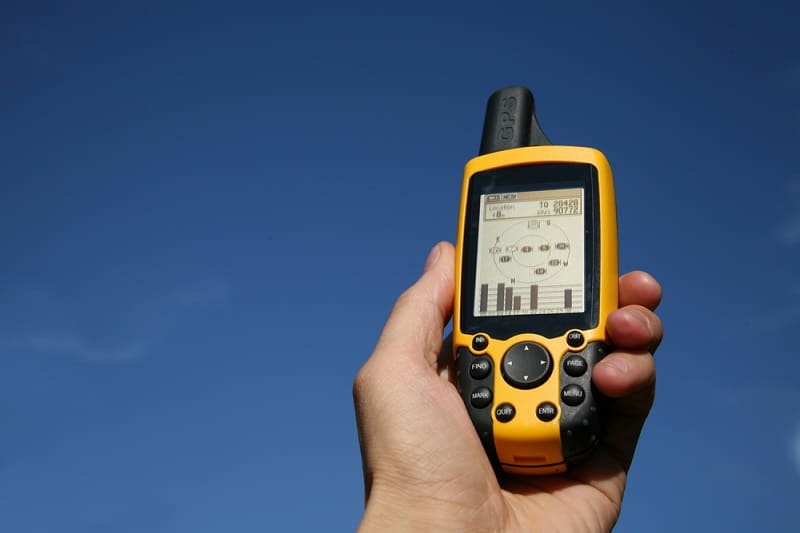
Inexpensive mobile GPS technology has changed the way we live. GPS on cell phones has replaced paper maps and given us services like Uber and a thriving home delivery culture.
GPS makes it easy for the ice angler to return to their last hot ice fishing spot or guide you off the ice in a surprise blizzard and get you back to your truck after fishing well into the night.
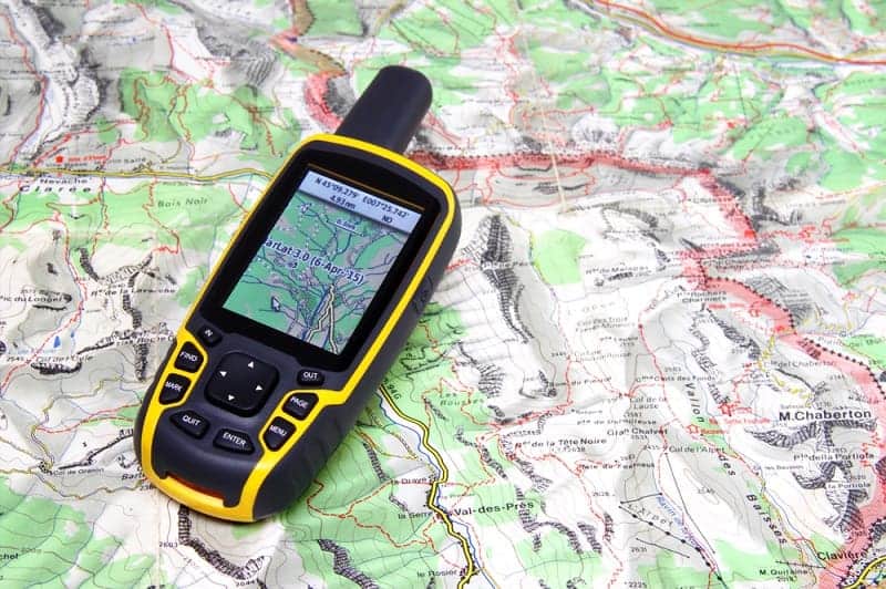
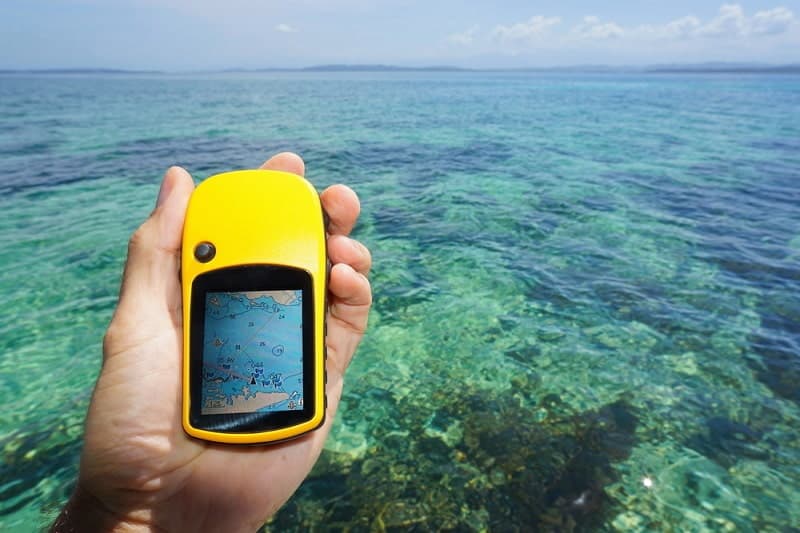
Handheld GPS/Sonar units simplify finding fish under the ice and knowing what features are best to meet your ice fishing needs before buying is vital in selecting the suitable GPS model. In this article, you’ll find a review of the 5 GPS models best suited for ice fishing and a buyer’s guide to help you choose a GPS.
IN A HURRY? HERE ARE 3 TOP PICKS FOR YOU


Contents
The Five Best Handheld GPS/Sonar Models for Ice Fishing
GPS is a versatile tool that helps Ice anglers return to old ice fishing hot spots. Handheld models make it easy to move from hole to hole while carrying a small amount of gear. Advances in technology have made it possible to give you the biggest bang for your buck by combining GPS and sonar in handheld units.
The Several of the Units listed below put both GPS and Sonar in the palm of your hand. One reviews a new, innovative technology from Deeper Smart Sonar, castab,le, GPS/Sonar.
1) Best Budget GPS – Garmin eTrex 32x
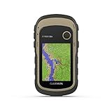
- Explore confidently with the reliable handheld GPS
- 2.2” sunlight-readable color display with 240 x 320 display pixels for improved readability
- Preloaded with Topo Active maps with routable roads and trails for cycling and hiking
Reviews hail the Garmin eTrex 32x as a lifesaver and an excellent product for first-time GPS users. An easy-to-read black and white interface allows you to explore unfamiliar terrain without fear of being lost in the wilderness or device technical gadgetry.
The eTrex 32x is a good entry-level unit for many end-users: Cyclists, hikers, kayakers, ice anglers, and more. Its high sensitivity WAAS receiver operates on GPS and GLONASS signals quickly pings and locks in your location.
A 2.2-inch black-and-white screen displays basic, topographic world maps. A user recommended hack for more detailed info is to download hikes from outdooractive.com. Transfer the GPX file to your Pro trex 10, go to the starting point, activate the GPX file, and begin your trip.
A basic entry-level GPS gets the job done and will guide you to the coordinates of your favorite fishing sites; however, if you want to upgrade your Pro eTrex 32x, the memory is limited, and updating the software may cause problems, or disable the unit.
What We Like
- WAAS receiver operating on GPS and GLONASS signals for quick, accurate locations.
- Onboard, worldwide topographic maps.
- 2.2-inch black-and-white screen.
- Simple, easy-to-use controls.
- Up to 25 hours use from two AA batteries.
What we don’t like
- Limited, unexpandable memory and outdated software may have problems when attempting to update.
- No Sonar capabilities.
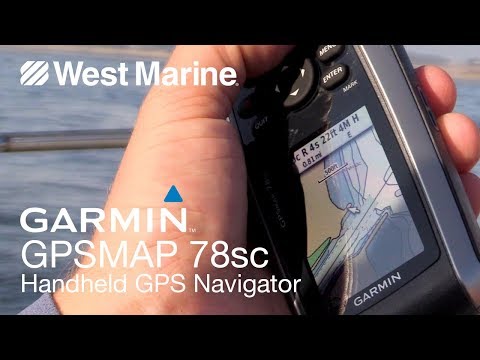
2) Best Water-resistant Handheld GPS – Garmin GPSMap 78sc
- Marine-friendly handheld with high-sensitivity GPS receiver and 2.6-inch color TFT display
- Perfect for boating/watersports--waterproof to IPX7 standards; floats in water
- Built-in BlueChart g2 U.S./Bahamas coastal charts with shorelines, depth contours, navaids, harbors, marinas, and more
Ice anglers can use the Garmin GPSMap 78sc with peace of mind because it’s not only water-resistant (IPX7), but it actually floats if dropped in the water. An onboard 3-axis compass makes navigating easy, and the built-in barometer alerts you of shifts in weather.
The 2.6 inch LCD screen displays shaded, world relief maps on the colored LCD screen. Keep a fix on your location with the GPSMAP 78sc quick, easy connectivity thanks to WAAS / GPS receiver locks on your location in extreme winter weather or a bleak, and dark lake when night fishing.
You can add topographic and marine maps to aid in navigating to and from fishing spots and support Garmin’s BirdsEye Satellite Imagery (Charges Apply). Effortlessly share your fishing location with friends or find and share data.
Quickly locate saved fishing sites via coordinates and waypoints (landmarks) stored in memory.
What We Like
- No worry, use near your ice holes or in storms thanks to IPX7 water resistance and because the unit floats.
- Operates for extended times on only two AA batteries.
- A 2.6-inch color screen displays maps clearly.
- An electronic tri-axial compass makes navigation easy.
- A Barometric altimeter aids in navigation and keeps you informed of weather changes.
- WAAS receiver gives quick fixes on your location, and wi-fi connectivity makes it easy to share information with friends.
What we don’t like
- If you need to add additional map sets to the GPSMAP 78sc it can become prohibitively expensive.
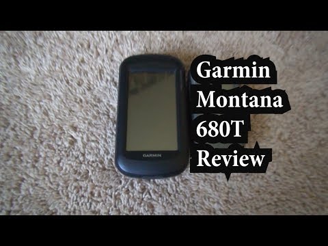
3) Best Glove Friendly Touch Screen GPS – Garmin Montana 680t

- SEE YOUR SURROUNDINGS - Includes a 1-year Birdseye Satellite Imagery subscription1
- GPS AND GLONASS - With its high-sensitivity, WAAS-enabled GPS receiver, Hotfix satellite prediction and GLONASS support, Montana locates your position...
- TRACK MANAGER - Ability to organize and navigate through waypoints/routes/track logs (easily start/stop recording track logs)
So, you love to ice fish, make your next trip out on the hard water easier with the glove-friendly Garmin Montana 680t touch screen GPS.
The 4 inch, sunlight-friendly, color LCD touch screen lets you easily read a displayed route and key in data and functions without removing your gloves, giving you more time to focus on your catch.
Built-in WAAS receiver and ultra-sensitive GPS & GLONASS reception lock-in on your location in severe winter weather or strolling through congested city streets. Garmin’s Track Manager and free Basecamp software make it possible to plot a course to a hot fishing spot on the ice or in a boat through multiple waypoints.
What We Like
- An 8-megapixel camera records geo-tagged images of waypoints, making it easy to return to favorite fishing spots.
- WAAS-enabled receiver with GPS & GLONASS tracking locks in your location quickly.
- It has a large 4-inch diagonal touch screen for easy viewing and touch screen control.
- Track Manager navigates through planned routes and waypoints while logging your progress.
- An 18-hour rechargeable lithium-ion battery is included. And it can also operate on two AA batteries for up to 22 hours in power saver mode.
- A 1-year subscription to Garmin’s BirdsEye Satellite Imagery included.
What we Don’t like
- Technology is outdated, and downloading map packages, or updating them can be difficult to complete.
4) Best Full Featured handheld GPS – The Magellan Explorist 510

Built for serious outdoors people and hikers, the Magellan Explorist 510 is a high-end, full-featured handheld GPS that will handle anything your ice fishing outing can throw at, and it’s waterproof to IPX7 standards.
A three-inch high resolution, sunlight-readable touch screen displays complete 2-D and 3-D world maps of entire road networks in North American, Western Europe, Australia, and primary roads around the rest of the world.
It will please ice anglers to know these preloaded maps also chart water features and rural land. Readily customizable with maps from multiple online sources or personalized notes from your fishing trips. Easy navigation through waypoints to high-producing fishing spots.
A built-in 3.2-megapixel camera is microphone and speaker enabled for saving geo-tagged images, voice notes, or videos to help retrace paste routes. The 3.2 Mega-pixel camera is adequate but inferior based on current standards.
What we Like
- Three-inch high resolution, sunlight-readable screen.
- Touch screen navigation with two programmable hard buttons.
- Extensive library of preloaded world maps with water features.
- Dedicated SiRFStarIII GPS chipset with WAAS, EGNOS, and MSAS satellite signals giving worldwide location accuracy within three meters.
- Up to sixteen-hour battery life on two AA batteries, longer in the suspended model.
- Waterproof to IPX7 standards and submersible to 1 meter for as long as 30 minutes.
What we don’t like
- The 3.2-megapixel camera is at least 15 years outdated based on current standards.
5) Best new Technology – Deeper Pro Cast Plus Sonar
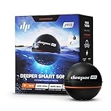
- HIGH SPECS: Casts out up to 330ft and scans down to 260ft. Precise 2.5cm target separation. Compatible with iOS and Android devices.
- REAL-TIME DATA: Two beam frequencies with 15 scans per second. View depth, see bottom structure and consistency, vegetation and fish.
- GPS MAPPING: Create bathymetric maps from the boat, canoe, kayak. Access all your scans, maps, points of interests, photos and notes on the Fish...
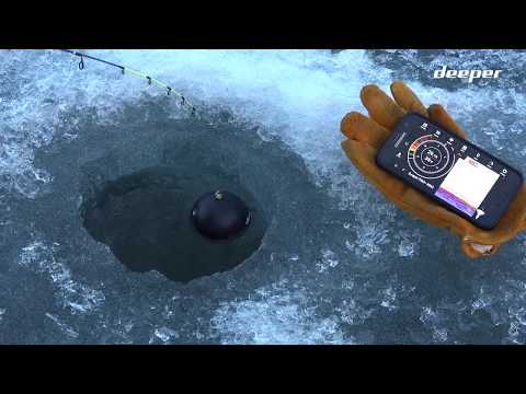
The entry represents a new class of castable sonar units that are must-haves to the fishing tackle of avid, budget-minded anglers—Designed for shore fishing or open water fishing. They work for ice fishing because, as you know, sonar penetrates through the ice.
In a nutshell, The Deeper Pro Cast Plus is a sonar unit made to attach to a minimum 8-10 lbs test line and cast out with a medium action or higher fishing rod. (For more on fishing rods, click here)
The Deeper pro-Cast Plus breaks out of the pack with its GPS capabilities. Not only does it provide GPS coordinates, but it creates a bathymetric map of the area below and around its location.
The Deeper Pro Cast Plus sends sonar images directly to your smartphone that rival those of much more expensive boat-mounted units. Stored data includes. Sonar image catches registered by users, coordinates, and depths at the catch site and saves no personal data.
To use on the ice, make a well on the ice with a clear spot in the center, add water and float the Pro Cast unit in the middle. Its sonar shoots through the ice then send images of fish activity, GPS coordinates, and other data to your smartphone.
What we like
- The Deeper Pro Plus scans an area up to 330 ft. or 100 meters wide and as deep as 260ft, perfect for locating lake trout any time of year.
- It easily syncs with ios and android smartphones, all data stored in the cloud.
- No internet is needed, because it connects to a phone, tablet, etc., via onboard wi-fi.
- Built-in GPS stores all data in the cloud. Data is accessible via your cell with the free deeper app.
- Two sonar frequency scans every 15 seconds, producing clear and current images of the fish area structure below.
- Shoots images through the ice, finding fish, depths, and bottom layout.
- Quickly recharges the battery using a micro USB B-type cable.
- Durable, and fit in your coat pocket.
What we don’t like
- The built GPS isn’t a stand-alone unit, it links to your phone’s GPS to mark locations. If you want to input coordinates, you will need your smartphone.
Handheld GPS Buyers Guide
If you’re techy like me, shopping for an electronic gadget like the GPS models we’ve been examining is like being a kid in a candy store. There are so many bells and whistles to choose from, each one better than the last, all of them feel like must-haves, but which ones do you need?
To help you make the right choice the first time, I will review features and why they may or may not suit your ice fishing needs in the following Buyers Guide.
How You Plan to Use Your GPS Decides What Options You Need?

If you’re going to use your GPS solely for ice fishing, then a basic model like the Garmin eTrex 32x will do an excellent job of getting you from point A to point B and back again.
However, if you plan to tackle the Appalachian Trail this summer or take up Geo-caching, then the or the Garmin 680t are more suited to your needs. The comes fully loaded with world maps.
Make a list of how you see the GPS is used, then select a model with those features.
Screen Display

Since you’ll be using the GPS outdoors, your first concern is choosing a model with a sunlight-readable screen. Avoid models with TFT displays that tend to wash out in the sunlight to achieve sunlight readability. LCD screens with “Positive Mode” displays will be readable in sunlight.
Another way to achieve sunlight readability is to overpower the sunlight, which simply means turning up the screen brightness, which will shorten battery life.
Larger size screens make it easier to read displays and let you pay more attention to your fishing. Touch screens are more accessible to control with gloves on than small buttons. That’s a real plus for the ice angler.
On-Board Map Packages

Many GPS boasts the ability to display multiple types of maps, but not all GPS comes preloaded with even basic map sets. When maps aren’t included, some manufacturers make you pay through the nose to get them. Be sure the model you choose includes the base maps you will use the most. Adding new map sets can be very expensive.
The comes preloaded with an extensive mix of base maps. Read owner reviews of the model GPS you choose to see which are easy to work with because some models can present software issues when updating.
IPX7 Water-resistant Case

Any kind of fishing means a lot of water. Ice fishing is no different. Protect your investment from the start by selecting a GPS that is IPX7 water-resistant, or better, one that is submersible to one meter for up to 30 minutes like the Magellan Explorist 510.
GPS Receiver

The GPS receiver is the heart of your GPS unit. You want, at minimum, a WAAS-enabled receiver using both GPS and GLONASS signals for fast, accurate locations in various conditions. For better and quicker location fixes, look at GPS with SIrFstarIII chipset using GPS, EGNOS, and MSAS signal for a location lock within 3 meters.
Cameras

Cameras aren’t a must-have with a GPS, but they can provide geotagged photos to help locate a destination or even mark waypoints when ice fishing. If you want a GPS with a camera, look for the highest available Megapixel rating and adequate memory with room for a micro SD card.
Sonar

Okay, I admit, sonar with your GPS is not a must-have, but it is a real value-added feature to a GPS unit for anglers. The problem is, it’s hard to find in a truly portable, portable handheld unit.
Our one entry that is handheld is the Deeper Pro Cast Plus.
The Pro Cast Plus is more sonar than GPS, but it provides Bathymetric GPS contour mapping and can guide through waypoints to a location, and it won’t break the bank, making the Pro Cast Plus well worth consideration.
Wrapping it Up
I’m torn between two of our selections. Each has its strong points and too few weaknesses to rule them out. The Magellan Explorist 510 and the Deeper Pro Cast Sonar / GPS.
If I were choosing a GPS unit strictly, I would go with the Magellan Explorist 510 as the hands-down winner. It has high-end GPS hardware, an easy-to-use touch screen. The Magellan boasts a complete onboard map set, and not only does it float, but it’s submersible.
The Deeper Pro Cast Plus will do everything I want from a GPS for fishing and give me sonar’s added advantages.
The Pro cast Plus will map the bottom, store location coordinates, and guide me to previous locations. It will also show me where the fish are when I’m ice fishing and on open water, more value-added.
The Deeper Pro Cast Plus gives me GPS and Sonar in one unit and more value for my dollar without digging as far into my wallet. So, in the end, it’s my ultimate choice, and I think it will work for you as well.