
Many people find ice fishing to be tougher than open water fishing for one primary reason. They think it’s tougher because they don’t know how to actually find fish.
When you’re fishing during the warm weather you can see things like stumps, grass, and ripples in the water. These things can indicate a fish and help you determine your ideal casting spot.
With ice fishing, it’s nothing but ice and snow. How do you know where to drill your hole?
Learning how to read lake maps for ice fishing can help you find ideal fishing spots without even needing to see the water beneath your feet. In this guide, you’ll learn how to read these maps and use them to your advantage.
Contents
What is a Lake Map?
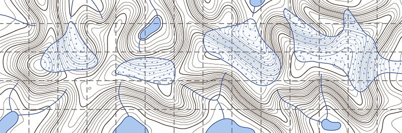

A lake map is a topographic map containing all the features of the water you’re fishing. These maps will contain information about the structure of the lake, the bottom, drop-offs, dams, vegetation, and more.
All of this data is important because it will help you identify ideal fishing locations as you’re navigating around the lake.
When you’re looking at the lake map, you want to look for landmarks as well. These will serve as structures for the fish to hide in and increase your chances of finding something. Some of these landmarks can include sunken boats, bridges, trees, docks, and more.
All of these items serve as a place for the fish to hang out and as a result, if you can find them, you can find the fish.
Why Does This Matter for Ice Fishing?
Believe it or not, learning how to read lake maps is even more important for ice fishing than open water fishing. This is because you can’t simply cast wherever you want. When you’re ice fishing, you have to drill a hole if you expect to wet your line.
This means that you need to drill when you’re certain you’ve identified an ideal fishing spot. The best way to find these spots is by reading a lake map.
What Type of Lake Map Should You Use?
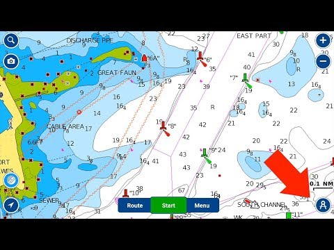
Navionics is one of the most popular lake maps in the United States for freshwater fishing. Their maps contain over 10,000 lakes in the US. They contain contours and great topographical detail that will help you identify spots where fish hang out.
The most important factor to look for is resolution. When you’re reading the map, you want to make sure that the resolution is clear and the image is easy for you to see. The best option for you is to consider getting an ice fishing fish finder.
A unit like the Garmin Striker 4 will provide you with maps while also allowing you to use the transducer through the ice. This makes life a lot easier and helps prevent you from planning at the last minute when you’ve already made it to the ice.
Planning Ahead
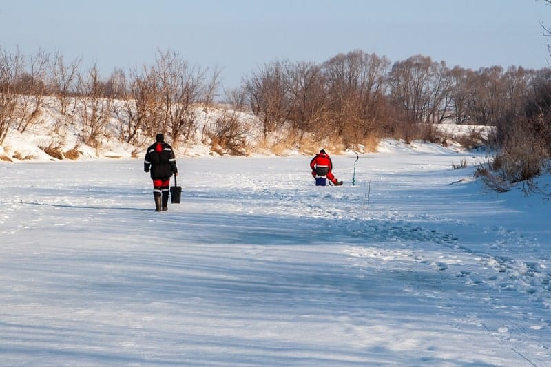

Speaking of planning, why wait until you get there to start mapping your course? The best choice you can make is to get on the water before it freezes over. When you’re just starting out ice fishing, a popular recommendation that a lot of ice anglers will tell you is to scout the water before ice fishing season starts.
Why?
Because you can go around the entire lake and identify much of the structure and vegetation where fish will hide. Keep in mind that while their habits change during the winter, they still hold to the same structure and hang out in a lot of the same places as they do when the weather is warm.
So, if you can map out a travel path based on what you see in the open water, you can implement that strategy in the winter as well.
How to Read a Lake Map?
Reading a lake map is a lot easier than you think. Here are some of the things you’ll see on a lake map and how you can read it.
Structure
The word you’ll hear me say time and time again is structure. To really make the most of your map, you need to be able to identify changes in structure on the bottom. This doesn’t always mean looking for underwater boats and things of that nature. Sometimes it means finding an area where the water is deep along a channel of two more shallow sections.
Chances are, the fish will hang out in the deeper channel because they’ll feel more protected. This could also be an area where a lot of baitfish are hanging out, so this could motivate the larger fish to hang out here as well.
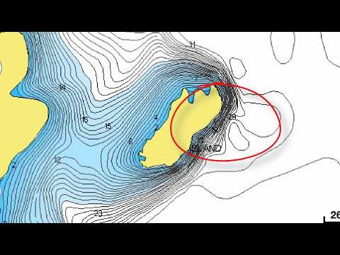
On a topographical map, deeper areas are generally indicated by a change of color. The lighter the color, the deeper the water.
As the bands narrow and become darker, this indicates a steep change in structure which tells you that there is an underwater hill or point there. You wouldn’t want to drill at the point, but you’d want to drill at the contour leading up to the point.
Contours
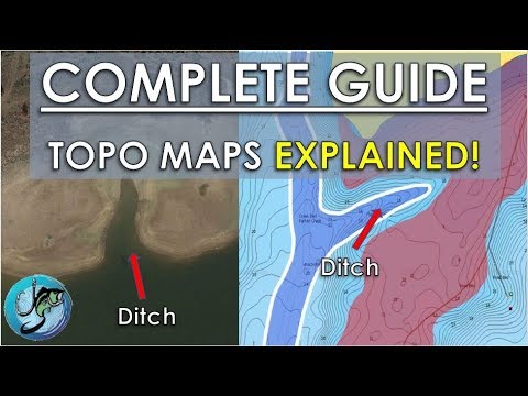
![How To Find Fishing Spots Using Bottom Contour Maps [Navionics Webinar]](https://fishontheice.com/wp-content/plugins/wp-youtube-lyte/lyteCache.php?origThumbUrl=https%3A%2F%2Fi.ytimg.com%2Fvi%2FsiJHneLoF7g%2F0.jpg)
I’ve talked a bit about contours, but let me explain why they’re so important. While the science behind it is wide open, we know that fish tend to hang around in areas where structure changes. These areas are also referred to as contours.
These contours in the lake floor are areas where the bottom dips or rises. These are areas where fish tend to hide out because they feel that the drop in gradient makes them seem more hidden.
Ideally, when you’re determining where you should drill your ice fishing hole, you want to drill near drop-offs.
Depth Ranges


Another important thing that a lake map will tell you is the actual depth range of where you’re planning to fish. Let’s go back to the example of an underwater hill. As the bands on the map thin out, that indicates a steep change in structure.
With that steep change, you’ll also be able to see what the actual depth of the water is so you can fish at the depth you want based on what you’re targeting.
Some fish, like catfish, tend to hold more to the bottom of a lake, whereas bass during a warm stretch may come near the surface to feed on bugs.
Understanding the depth of the water beneath you gives you a significant advantage in ice fishing because you’ll have an easier time targeting the species you want.
Final Thoughts
Understanding how to read lake maps for ice fishing is a great skill that everyone should learn. If you’ve never read a map before, now is the time to do so. Whether you choose to download an app on your phone or purchase your own fish finder, a map can give you a serious advantage over other anglers.